More on I-684 : Asked and Answered (at least to my satisfaction — your results may differ))
/
A couple of readers of the original post on I-684 offered different theories on why the route runs through GReenwich, so I posed further questions to ChatGTP:
Question:
I posted your history on I-684 and several readers added other claims/allegations. The first is that, in order to qualify as an "interstate" and thus qualify for federal funding, the road has to pass through at least a portion of CT, and this then nearly undeveloped corner of Greenwich was selected. The second was a claim that then-First Selectman of Greenwich, Lowell Weicker, later to go on to the Senate, then the governorship, played a hand in bringing the road into Greenwich in order to get a slice of federal pie and placate the rich folk living further east who feared that an alternative route would run through their porperty.
I do remember reading the "qualify for federal funding" theory before, but the second claim about Weiker I'm not so sure about; Weicker was involved in lots of shady deals during his time in Greenwich, but this particular ploy doesn't ring any memory chimes. Some of us still call the name of the huge curve, bending north for several miles before returning south, that the Wilbur Cross/Merritt Parkway takes at the NY/CT border as "Rockefeller's Loop", a reference to the Rockefeller family’s large land holdings inmiddle Greenwich that the kept free of the Depression era road project, and perhaps those two stories were conflated? Thoughts?
Answer:
The “must cross into CT for interstate/federal-funding” claim is a persistent myth with no factual basis. The Weicker involvement claim also lacks supporting evidence. The “Rockefeller’s Loop” nickname for the Merritt Parkway curve is local lore that mixes real landowner influence with specifics that don’t fully match the documented history.Federal-funding / “must enter CT” claimInterstate designation and the associated 90% federal construction funding under the Interstate Highway System did not require a route to cross state lines. Many Interstates lie entirely within one state (examples include I-4 in Florida, I-27 in Texas, and numerous others). Designation depended on inclusion in the approved national system of routes connecting major cities/metropolitan areas, meeting design standards, and receiving federal approval—not on multi-state mileage.
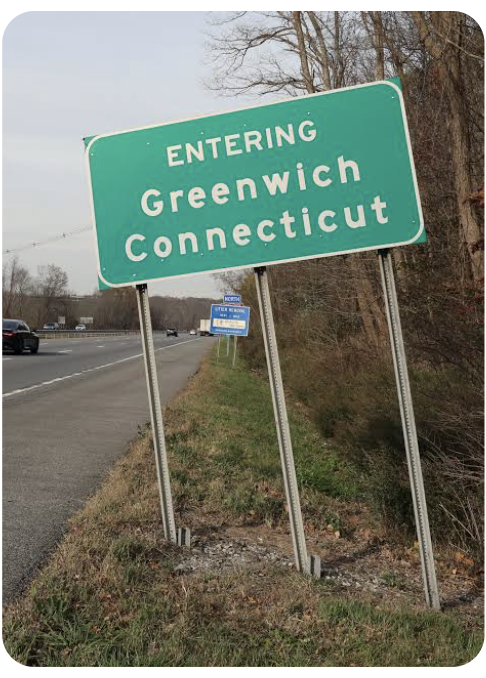
I-684 (originally planned and briefly signed as part of I-87) was a New York project along the NY 22 corridor to link the Cross Westchester Expressway/I-287 area northward toward I-84 near Brewster. The short (~1.4-mile) dip into northwestern Greenwich resulted from the final 1960s alignment decision east of Byram Lake. That choice prioritized:
Avoiding or minimizing impact on Rye Lake (part of the Kensico Reservoir system, a New York City water-supply source).
Reducing harm to wildlife sanctuaries and other features compared with western alternatives.
nycroads.com
….
People sometimes recall a “had to touch CT” story, but contemporary engineering records and later histories attribute the path to reservoir protection, terrain, and impact minimization—not funding rules.
Weicker Claim:
Lowell P. Weicker Jr. served as Greenwich First Selectman roughly 1964–1968 (after earlier service in the Connecticut House). He later became a U.S. Representative, Senator, and Governor. No reliable historical accounts link him to the I-684 routing decision or to any scheme to “bring the road into Greenwich” for federal money or to shield richer properties farther east.
The core route choices and public hearings occurred mainly in 1961–1964 (NY engineers, Westchester stakeholders, CT state officials including Gov. John Dempsey). Construction of the southern section (including the CT bit) proceeded in the mid-to-late 1960s and opened in 1968. Weicker’s documented local priorities as First Selectman centered on items such as the train station, Greenwich Plaza development, and parks—not this highway alignment. The geography also doesn’t support a “protect the rich farther east” motive: the CT segment is the far northwestern corner; alternatives under debate were primarily within New York towns, and eastern Greenwich properties were not the ones at issue.Claims of “shady deals” exist in other contexts of Weicker’s career, but this particular ploy does not appear in road histories, contemporary reporting, or later accounts. It reads as later folklore or conflation.
“Rockefeller’s Loop” on the Merritt / Wilbur Cross Parkway
This is local nickname/lore for the pronounced northward curve (or “bulge”) the Merritt Parkway takes near the NY/CT border in Greenwich before continuing. The Merritt (1930s Depression-era project, completed ~1938–1940) was designed as a scenic, landscaped parkway that followed terrain and faced strong opposition from wealthy Fairfield County landowners who formed groups to shape or resist alignments that would cut through estates.
Documented accounts attribute the specific Greenwich curve more directly to resistance from industrialist Henry Croft (and other “blockers”), who successfully pushed the route north of his holdings along Clapboard Ridge Road / Grahampton Lane, creating the lasting bulge.
The Rockefeller family did hold extensive land in Greenwich (William A. Rockefeller and descendants in areas including Glenville, Lake Avenue vicinity, Deer Park, Rockwood, Indian Spring, etc., totaling hundreds of acres at peaks; some later subdivided). Their influence, along with other Gold Coast estates, contributed to the broader pattern of wealthy opposition that shaped the parkway’s curving, less-direct path. However, primary sources do not single out Rockefeller holdings as the direct cause of that specific loop in the way the nickname implies. (Separate allegations of route shifts to avoid Rockefeller properties appear more in the context of I-684 planning farther west in New York’s Pocantico Hills area.)
In short: the colonial border created the panhandle that made a CT dip possible, 1960s engineering and environmental choices (not funding rules or Weicker) put I-684 through the undeveloped northwest corner without ramps, and the Merritt’s famous curve reflects 1930s landowner politics (with Rockefellers as part of the wealthy milieu, but not the sole documented cause of the nickname’s specific feature). Local memory often blends these threads, which is understandable given the region’s layered history of powerful estates and highway fights.
{So now on to Henry Croft — wh was he? Part III, above}